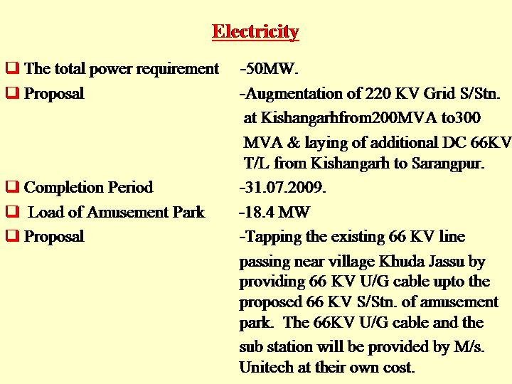
Overview
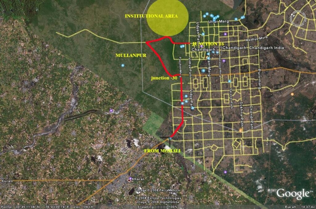
The Chandigarh Administration is developing an Institutional area of 1100
acres at Sarangpur.
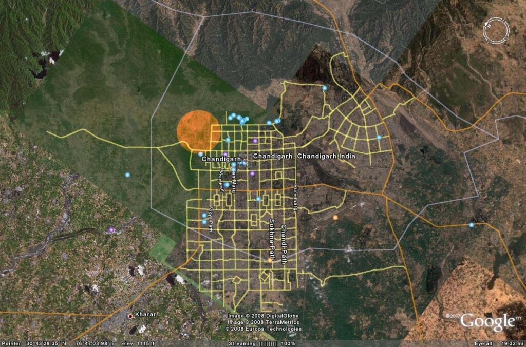
LOCATION PLAN OF INSTITUTIONAL AREA
The TOR (terms of reference) for this presentation are as under:
- Adopting a HOLISTIC approach to the development of the NorthWestern part of the City Beautiful. providing . “complete
environmental solutions.” - Evolving a CIRCULATION SYSTEM that creates alternate methods
of connectivity for allowing un-interrupted traffic flow to the
Institutional area. - Evolving a rational engineering and landscape design solution to
allow un-interrupted traffic flow to the Institutional Area (1100 acres)
from Mohali upto Junction 30 and further on upto UT Boundary and
Junction 16 to UT Boundary - Evolving Landscape methodologies for Landscaping of Primary and
Secondary circulation spines created for the above - Landscape design Strategies for Development of Patiala Ki Rao
- Plantation plan for Institutional Area (1100 Acres)
- Junctions and Entrances
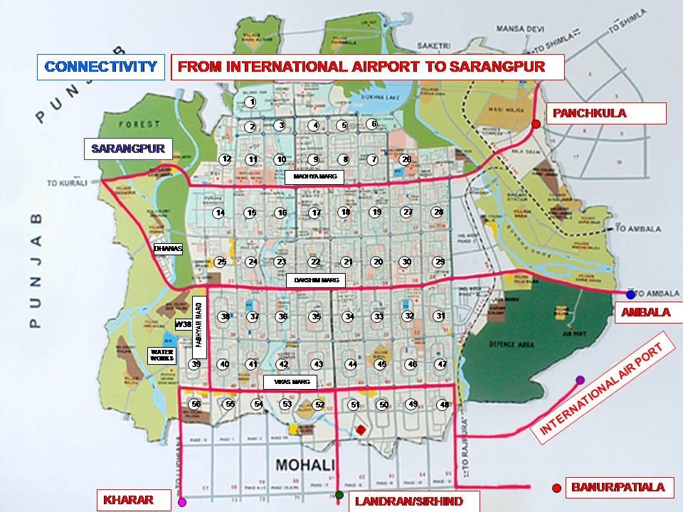
PLAN INDICATING LINKAGES TO INSTTUTIONAL AREA
OUR INTENT
“to develop the entire area into a world class development on the
principles of the policy of “complete environmental solutions” dovetailing
the principles of engineering into landscape design and aesthetic
treatments to evolve solutions which are workable, aesthetic and above
all sustainable”
LANDSCAPING – A COMPLETE AND COMPREHENSIVE APPROACH
AND NOT SIMPLY A BEAUTIFICATION EFFORT
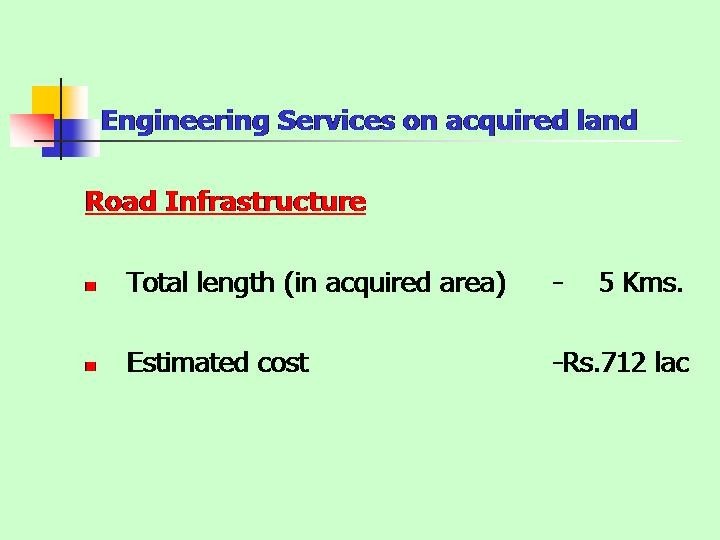
ROAD NETWORK AND LINKAGES
A GLIMSE OF THE OVERALL PROPOSAL
PRIMARY ROAD NETWORK
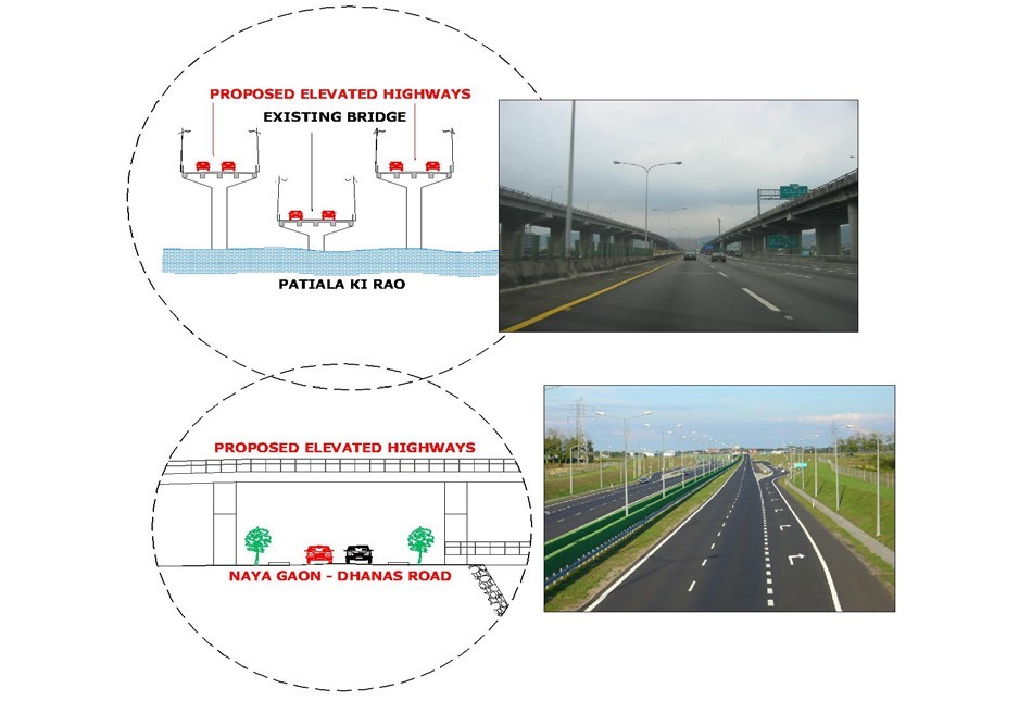
- WIDENING OF ROAD FROM PGI (JN 16) AND CONSTRUCTION
OF ELEVATED HIGHWAY ACROSS PATIALA KI RAO AND
OVER KHUDA LAHORA, WITHOUT DISTURBING THE
EXISTING ROAD INFRASTRUCTURE INCLUDING PROVIDING 3
LANE DUAL CARRIAGEWAY UPTO UT BOUNDARY AT
MULLANPUR.
- WIDENING OF THE ROAD ENTRING CHANDIGARH FROM MOHALI
(PASCHIM MARG) INTO A 3 LANE DUAL CARRIAGEWAY
PROVIDING A ROTARY AT JUNCTION NEAR SECTOR 25 (JN 30).
- WIDENING THE ROAD FROM JUNCTION 30 TO UT BOUNDARY AT
MULLANPUR INCLUDING CONSTRUCTION OF ADDITIONAL 3 LANE
HIGH LEVEL BRIDGE TOWARDS THE UPSTREAM SIDE OF PATIALA
KI RAO
SCHEMATIC LINKAGES SHOWING PRIMARY ROADS
SECONDARY ROAD NETWORK
- WIDENING OF ROAD RUNNING ALONG THE PATIALA KI RAO
FROM UT BOUNDARY (NAYA GAON) TO HIGH LEVEL BRIDGE
DHANAS, INTO A 2 LANE ROAD.
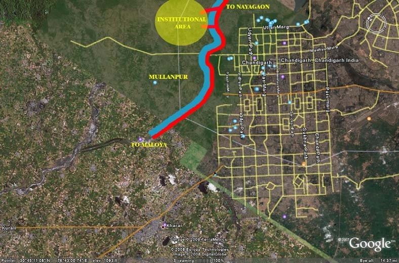
2 ) PROVIDING 2 NOS ADDITIONAL LINKAGES TO INSTITUTIONAL
AREA FROM THE ABOVE 2 LANE ROAD
PROPOSED ROAD RUNNING ALONG PATIALA KI RAO
LANDSCAPE PROPOSAL FOR THE PRIMARY ROADS
OUR AIMS & OBJECTIVES
The Proposal aims to foster best practice in landscape design and
management of the entire area with the key objectives of evolving
design strategies which have inherent mechanism for :
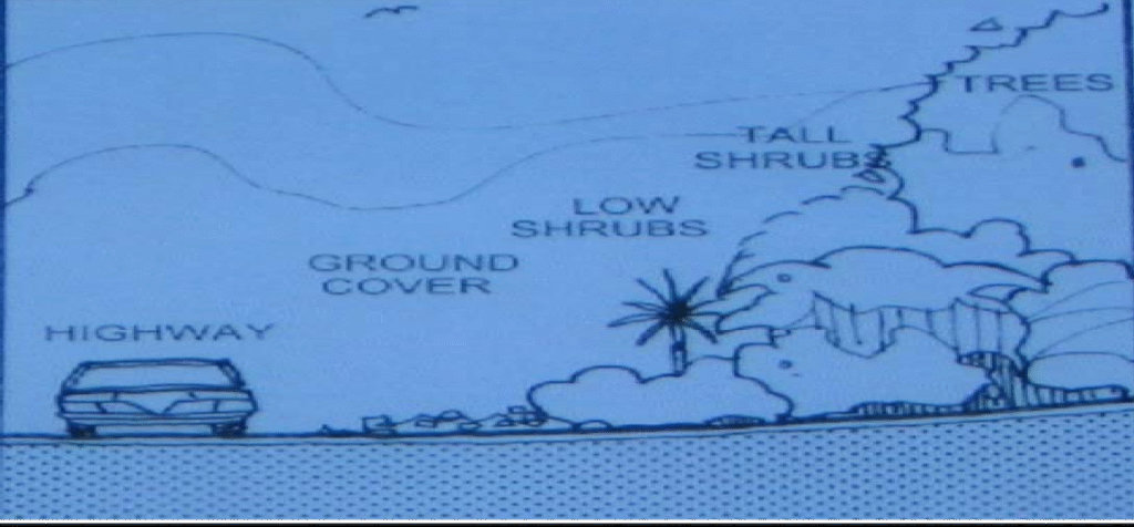
- opening up and enhancing visual qualities of scenic areas and
camouflaging unwanted views - evolve horticultural strategies for the entire development providing
native and self sustaining plant materials. - evolving signage and graphical and pictorial illustrations
- sustenance and maintainability of the proposed development
scheme - infusing inherent qualities to prevent misuse by hawkers, vendors
etc
IN ORDER TO MAINTAIN UNIFORMITY IN THE VISUAL TREATMENT ,
IT IS PROPOSED THAT THE LANDSCAPE TREATMENT FOR THE
PROPOSED PRIMARY ROADS BE UNIFORM.
Both Mullanpur and JN 55 (Entry Point from Mohali) are MAIN ENTRY
points to the City beautiful and any attempt at evolving the landscape
needs to depict the Strong architectural character of the City as one
approaches it —– “A GLIMPSE OF THE EXCEPTIONAL
ARCHITECTURE AND PLANNING OF THE CITY”.
Basic elements in the character which are being highlighted are:
- ORDER
- UNIFORMITY
- UNITY IN DIVERSITY
It is therefore proposed that :
There be a complete harmony in the design of the Landscape of the
complete stretch. The same is being achieved by:
Uniformity in :
- Architectural elements
- Planting design and choice of Species
- Lighting design
- Signage design
SLOPES ALONG ROAD CHECK ENCROACHMENTS BY HAWKERS
ETC
The key elements of design are:
- SAFETY
- VISUAL QUALITY
- SUSTAINABILITY
With an inherent mechanism to check encroachments — achieved
by Slopes / mounding
ADDRESS ISSUES OF SUSTAINIBILITY OF ALL DEVELOPMENT BY
USE OF ALTERNATIVE PLANT SELECTION AND GROUND COVERS
SELECTION WHICH ARE MAINTENANCE FREE.
UNIFORMITY IN TREATMENT LENDS A STRONG CHARACTER
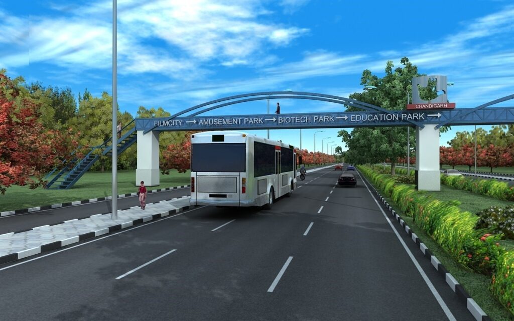
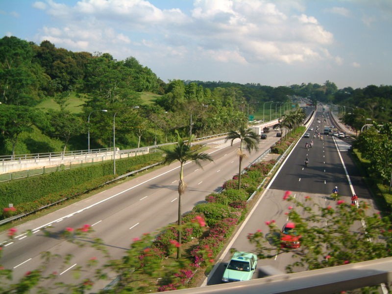
TYPICAL SECTION FOR THE ROAD
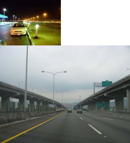
ELEVATED HIGHWAY
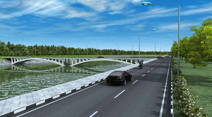
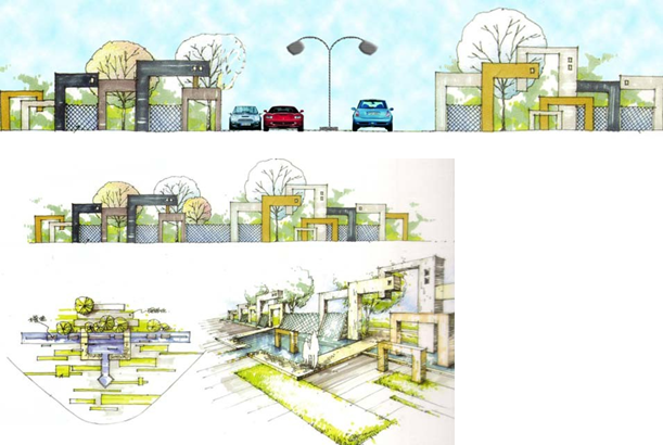
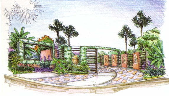
JUNCTIONS/TRAFFIC ISLANDS:
The Junctions and entrances have been visualized in a manner that
they provide the necessary DIVERSITY and become “Landmarks” in
the overall continuum of movement.
Strong Visual ELEMENTS viz “ARRAY of COLUMNS” , juxtaposed
with exquisite shrubs and Ground Covers make the Junctions a
visually stimulating “PUNCTUATION”
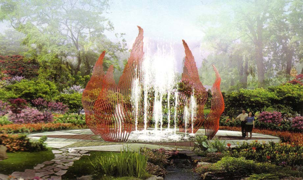
ENTRY
The Entry to the institutional area is through an aesthetically
designed Sculptural WATER ELEMENT on either side of the entry
SOME DATA OF THE INSTITUTIONAL AREA
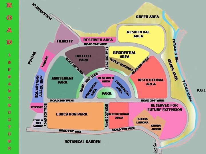
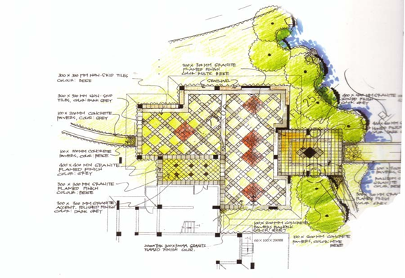
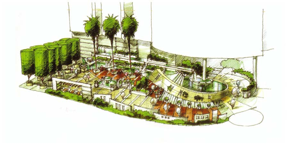
LAND-USE PLAN OF THE INSTITUTIONAL AREA
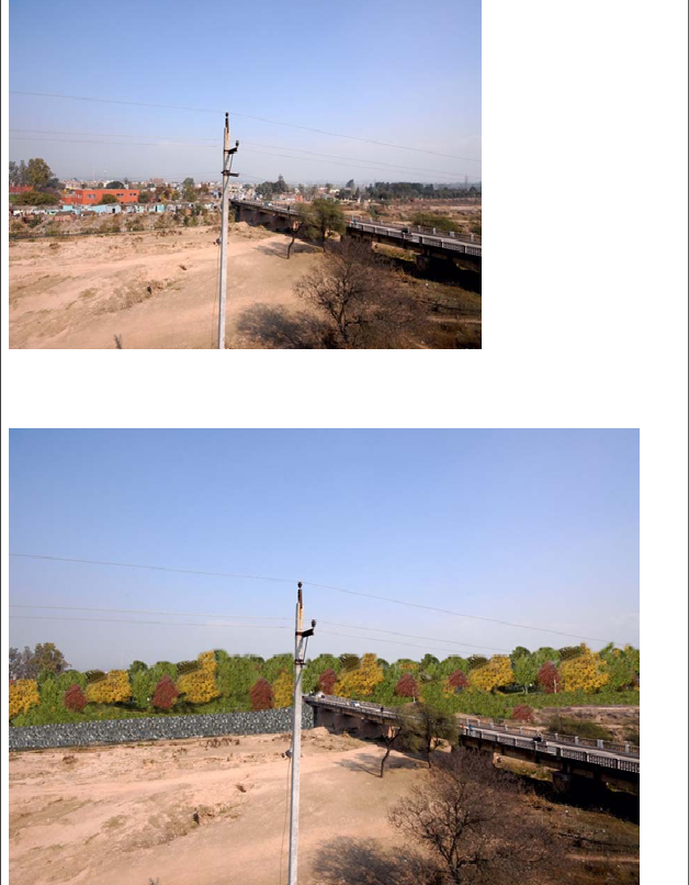
PATIALA KI RAO
The Patiala –Ki-Rao is a natural choe which flows along the north western
end of the city of Chandigarh. Running across the Patiala ki rao, is the
Madhya Marg, which passes through the village of Khuda Lahora and
leads to the proposed Institutional Area of 1100 acres being developed by
the Chandigarh Administration. The road connects to the UT boundary
with Punjab at Mullanpur.
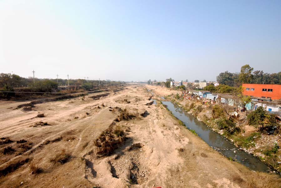
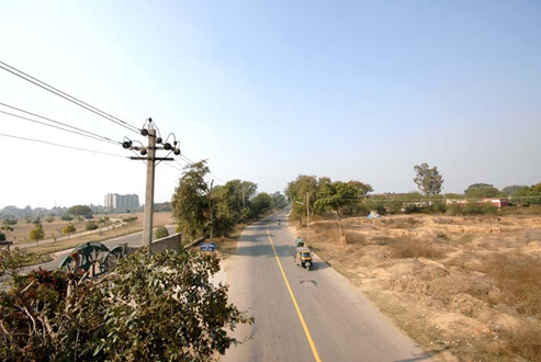
VIEW OF PATIALA KI RAO
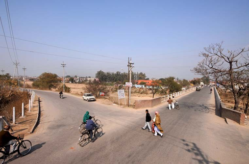
ROAD FROM JUNCTION 16 AT THE PATIALA KI RAO CROSSING
ROAD LEADING TO INSTITUTIONAL AREA
Assessment
Assessment, design and management are not separate processes but
part of one continuous and interactive process. Landscape assessments
help determine the likely or actual effects of the landscape: its character,
quality and environmental integrity. Visual assessments help determine
the visual effects of the area on people’s perceptions of the landscape.

EXISTING VIEWS OF PATIALA KI RAO
PATIALA – KI – RAO
- The exisiting width of the bed of the Patiala-ki-Rao is 70 metres
- The maximum water flow that the choe caters to is 6000 cusecs
Based on the above data provided by the Chandigarh Administration, the
following has been arrived at:
Expected discharge : 6000 cusecs
Velocity of water : 3.5 ft / sec
Wet x-sectional area : 6000 ÷ 3.5 = 1714.28 sft
Assume:
Depth of Choe : 10 ‘- 0″
Side slopes : 1 : 1
Bottom width : “A” (assumed)
2A + 20 ×10 : 1714.28
2
A + 10 : 171.42
A : 161.42
Top width = 161.42 + 20 : 181.42
Top width bank : 181.42 + 10 = 191.42
(assuming 5′ free board) i.e. 58.35 m …. Say 60m
Based on the above calculation, a consistent width of 60 meters has been
arrived at for the entire stretch of the Patiala Ki Rao.
Keeping the North-western edge of the Choe constant (due to the
difficulty in accessibility of the same and due to the fact that pitching on
certain areas has been carried out recently), an area of 31.5 Acres has
been reclaimed.
Also there are unplanned developments along the North-western edge
which need to be camouflaged.
This area is proposed to be Landscaped into Recreational and Cultural
facilities.
Further the following is proposed:
- To establish “STRONG” links across the Patiala ki Rao at 2-3
places and convert these links in large pedestrian piazza with
recreational facilities, children play areas, kiosks, fountains and
other visually stimulating features
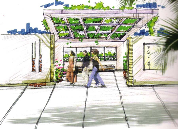
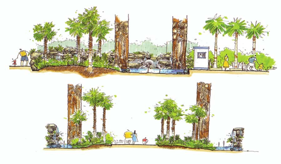
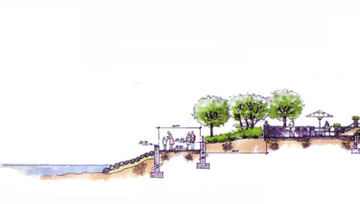
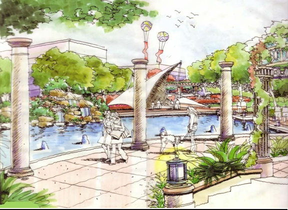
SKETCH OF LANDSCAPE ORNAMENTS
TREATMENT OF ENTRY POINTS
DECKS AND OPEN SPACES INCREASE SPATIAL EXPERIENCE
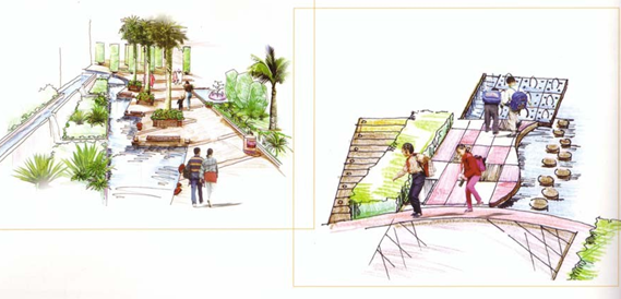
RELAXING CORRIDORS BETWEEN GREEN AND CHOE
The pedestrian piazza which is adjacent to the Lake created along the
Botanical shall provide the much needed physical approach to the
Botanical Garden from along the road.
SECTION ALONG THE CHOE
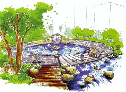
SKETCH OF PEACE PLAZA
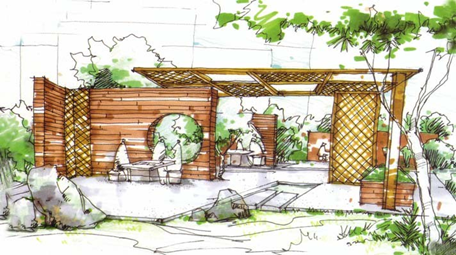
SKETCH OF A FOOD PLAZA
- To create pedestrian links 3-4 meters wide to provide pedestrian
connectivity over the choe. - To create adequate parking places which allow easy access to the
linear development. - To create a complete recreational experience for people so that this
area is transformed into a “recreational destination”
LANDSCAPE ELEMENTS
WATER AS AN ELEMENT LENDS TRANQUIL TO THE
ENVIRONMENT
THE COSTS
ROADS NETWORK
PGI (JN 16) TO UT BOUNDARY AT MULLANPUR
RS 5.22 CRORES
EXISTING ROAD TO BE USED AS SLOW CARRIAGEWAY IN THE PROPOSED PLANNING
CONSTRUCTION OF 2 LANE ELEVATED HIGHWAY
= 19200 SQM @23000/- RS 44.16 CRORES
CONSTRUCTION OF BRIDGES = 2340 SQM @35000/-
RS 8.19 CRORES
RETAINING WALL & APPROACH ROAD FOR RECLAIMED LAND OF PATIALA
KI RAO = L.S. RS 1.00 CRORES
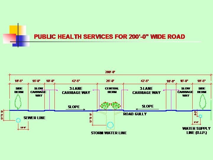
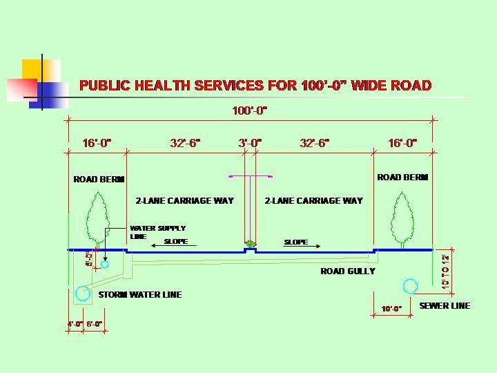
PROVISION FOR PH SERVICES = L.S. RS 1.00 CRORES
PROVISION FOR ELECT. INSTALLATIONS
= 0.75 CRORES
TOTAL = RS 60.32 CRORES
II) DUMPING GROUND (JN 30) TO UT BOUNDARY
EXISTING ROAD – CARPETING, WIDENING AND
PROVIDING ADDL LANES RS 7.57 CRORES
(CARPETING OF EXISTING ROAD = 55500 SQM @ 520/-
WIDENING OF ROAD = 39000 SQM@ 1200/-)
CONSTRUCTION OF 3 LANE BRIDGE
= 910 SQM @35000/-
RS 3.18 CRORES
RETAINING WALL & APPROACH ROAD
FOR RECLAIMED LAND OF PATIALA
KI RAO = L.S. RS 1.00 CRORES
PROVISION FOR PH SERVICES = L.S. RS 1.00 CRORES
PROVISION FOR ELECT. INSTALLATIONS
= 0.75 CRORES
TOTAL = RS 13.50 CRORES
III) ENTRY POING AT MOHALI TO DUMPING GROUND
CARPETING OF EXISTING ROAD = 8951 SQM @ 755/-
RS 0.70 CRORES
WIDENING OF ROAD = 17902 SQM@ 1200/-
(ADDL LANES & CARPETING RS 4.14 CRORES
PROVISION FOR PH SERVICES = L.S. RS 0.15 CRORES
PROVISION FOR ELECT. INSTALLATIONS
= 0.25 CRORES
TOTAL = RS 5.24 CRORES
B. PATIALA KI RAO
i) EARTHWORK
TOTAL AREA BEING RECLAIMED = 31.5 ACRES i.e.
127512 SQM
ASSUMING AVERAGE FILLING @ 4M = 510048 CUM
TAKE 50% @ 1 KM LEAD = 255024 CUM@ 115/-
RS 2.93 CRORES
TAKE 50% @ 300M LEAD = 255024 CUM @ 100/-
RS 2.50 CRORES
EMBANKMENTS
LENGTH = 3540 RMT
X-SECTIONAL AREA = 82 SQM
VOLUME OF EARTH = 2,90,000 CUM @ 115/-
RS 3.33 CRORES
TOTAL FOR EARTHWORK = 8.76 CRORES
ii) CONSTRUCTION OF PIAZZAS
AREA OF PIAZZAS 9960 SQM @RS 7000/-
RS 6.98 CRORES
iii) LANDSCAPING
TOTAL AREA TO BE LANDSCAPED = 33.87 ACRES@
RS 10,00,000/-
RS 3.38 CRORES
IV) STONE PITCHING
AREA OF STONE PITCHING = 3240 SQM @ 1950/-
RS 6.35 CRORES
V) ROAD ALONG PATILA KI RAO
CARPETING OF EXISTING ROAD 17600 SQM @ 520 /-
RS 0.92 CRORE
WIDENING OF ROAD FROM 5.5 M TO 10 M
14400 SQM @ 1120/- RS 1.61 CRORE
TOTAL FOR DEVELOPMENT OF ROAD RS 2.53 CRORE
TOTAL FOR DEVELOPMENT OF PATIALA KI RAO
= RS 28.00 CRORES
TOTAL COST FOR DEVELOPMENT OF ROAD NETWORK
79.06 CRORES
TOTAL COST OF PROJECT
28.00 + 79.06 = 107.06 CR0RES